Who built it and why?
Learn about the Romans in Scotland and why the Antonine Wall was created.

The Antonine Wall is just one small part of an extensive system of frontiers across the former Roman Empire.
At the greatest extent of the Roman Empire, its frontiers stretched for more than 3,000 miles across three continents. Sections of this vast system can still be seen across Europe in the UK, Belgium, Netherlands, Germany, Switzerland, Austria, Slovenia, Croatia, Slovakia, Hungary, Romania, Serbia, and Bulgaria. In the middle east and north Africa, Roman frontier remains can be seen in Algeria, Egypt, Iraq, Israel, Jordan, Libya, Morocco, Syria, Tunisia, and Turkey.
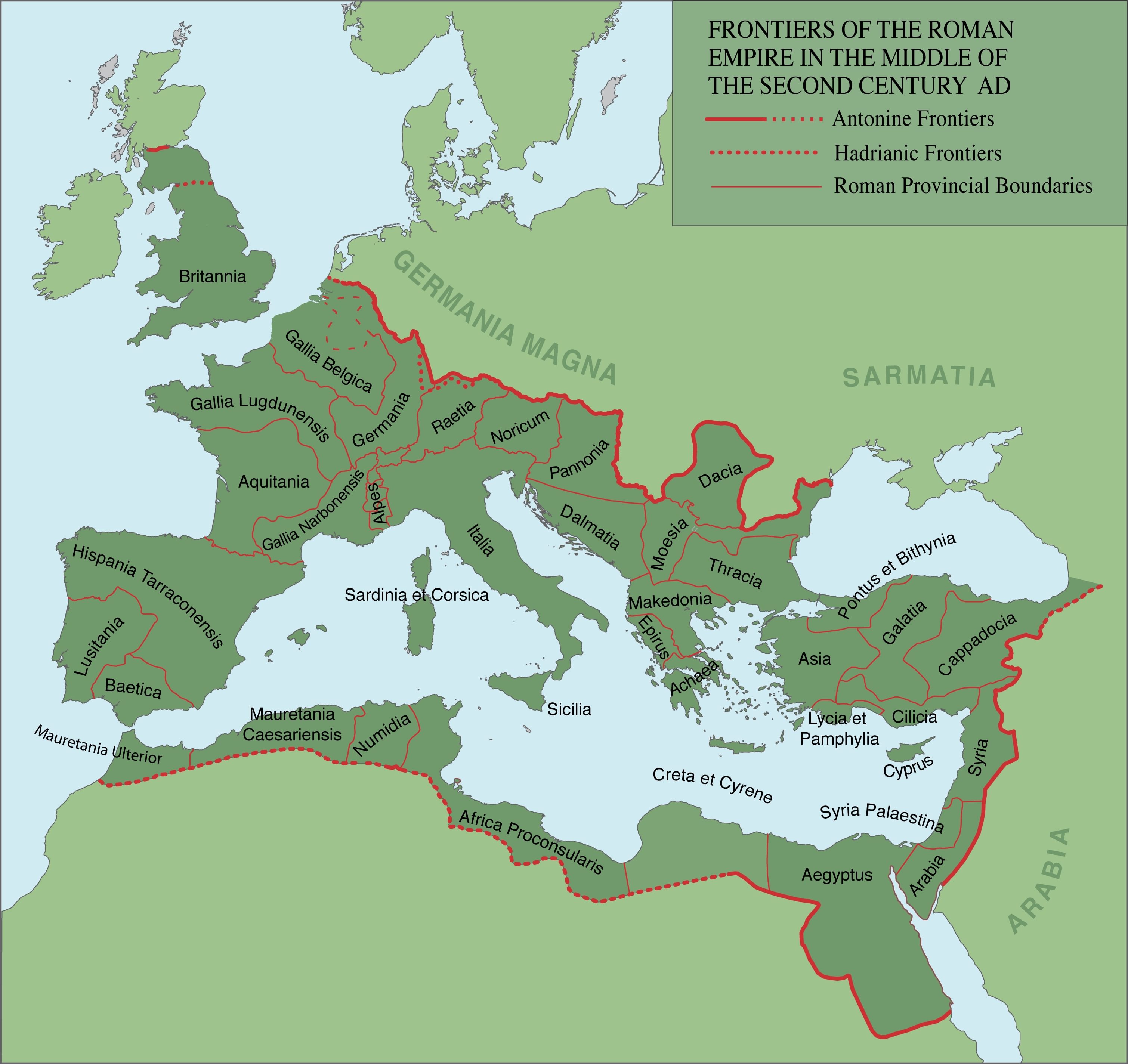
Each of these military frontiers had the same job: to define the limits of the Roman empire. However, they were not all identical with different structures across the frontier. In some places, artificial boundaries such as walls were built while elsewhere the Romans made use of natural boundaries such as seas or rivers.

As part of a transnational UNESCO World Heritage Site, discover how the Antonine Wall is protected and managed.
Learn about the Romans in Scotland and why the Antonine Wall was created.
Discover how the Antonine Wall was constructed.
Home to both soldiers and civilians, learn about the lives of the people who made the Antonine Wall their home.